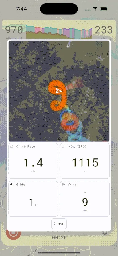
Thermal Assistant Instrument
Gaggle has a thermal assistant that can help you to visualise thermals while you are paragliding. While flying, it shows your flight in a simulated 3D space giving you a great mental model for where the thermal core is and the direction that it’s tracking. It’s also a great way to see where past thermals were if you need to hunt for a new thermal. The map automatically zooms in when you start thermalling so that you can better visualise the core, and it will automatically zoom out when you start gliding so that you can better see past thermal locations.

To open the thermal assistant you can tap the climb rate widget or, if enabled, it will automatically open when you start circling in a thermal.
The thermal assistant shows the following instruments:
- Thermal Map: The thermal map visualises your flight path in a simulated 3D space. Every dot in your flight path represents a second in your flight and the color indicates lift/sink intensity. The more red the color the higher the climb rate and the more blue the color is the higher the sink rate was. The map also shows a wind indicator to give you an idea of where the wind is coming from.
- Climb Rate: The current climb rate determined by your variometer.
- MSL: The current altitude reported by the GPS. Pressure altitude can vary a lot as you move through different air masses so GPS altitude can give you a better indication of your true altitude while in thermals.
- Glide Ratio: The current glide ratio based on your estimated sink rate and travel speed.
- Wind Speed: The current wind speed and direction.
