
Help Article
Flying Sites
Learn how to browse sites, create a site, and use site details in Gaggle.
Flying Sites
Use Flying Sites to discover launches, open site forecasts, save favourite sites, and jump into each site’s guide and chat.
You can open Flying Sites from:
- Explore > Flying Sites
- the Flying Sites card on Home
- Explore search results or nearby results
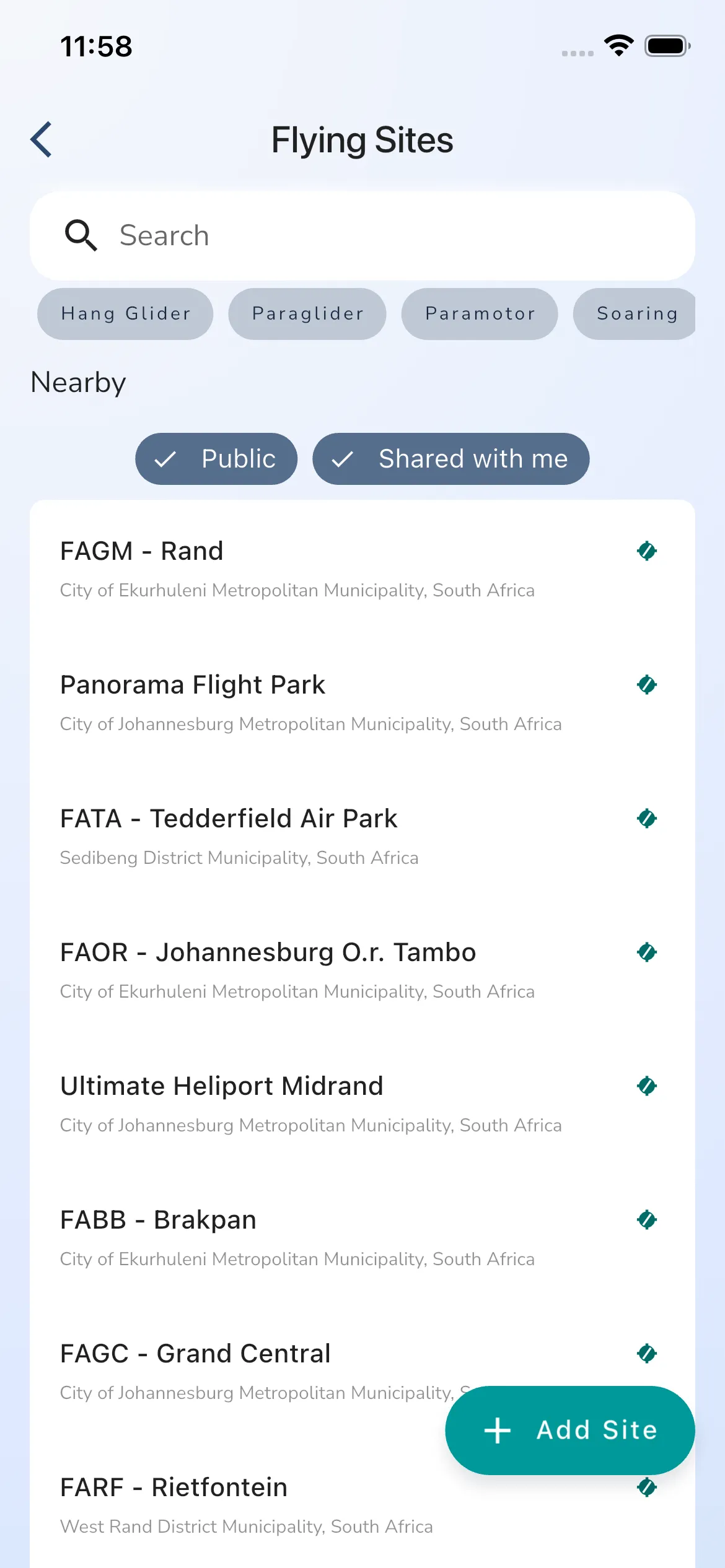
Browse the site list
The Flying Sites page is built for quick discovery.
From this page you can:
- search for sites
- filter by site tags such as aircraft type
- review your
Favouritesites near the top when available - scroll the full site list
- open any site to view its forecast and details
If you came from Explore, the nearby map and nearby list are often the fastest way to jump into a site directly.
Save a site as a favourite
Open a site and tap the heart icon in the top-right corner to mark it as a favourite.
Favourite sites are used across Gaggle for:
- faster access from the Flying Sites card on Home
- quicker access from search and nearby flows
- site-level alerts where supported
Create a new site
Creating and managing flying sites is part of the Adventurer plan. On other plans, Add Site opens the upgrade sheet. You can also add a site from the Explore map: press and hold a spot and tap Add Site.
Tap Add Site from the Flying Sites page.
Creating a site is a guided multi-step flow:
- choose the site location
- review a nearby-site warning if Gaggle finds an existing site in that area
- add the site details
- choose visibility and site protection settings
- configure the wind guide
- finish on the new site page
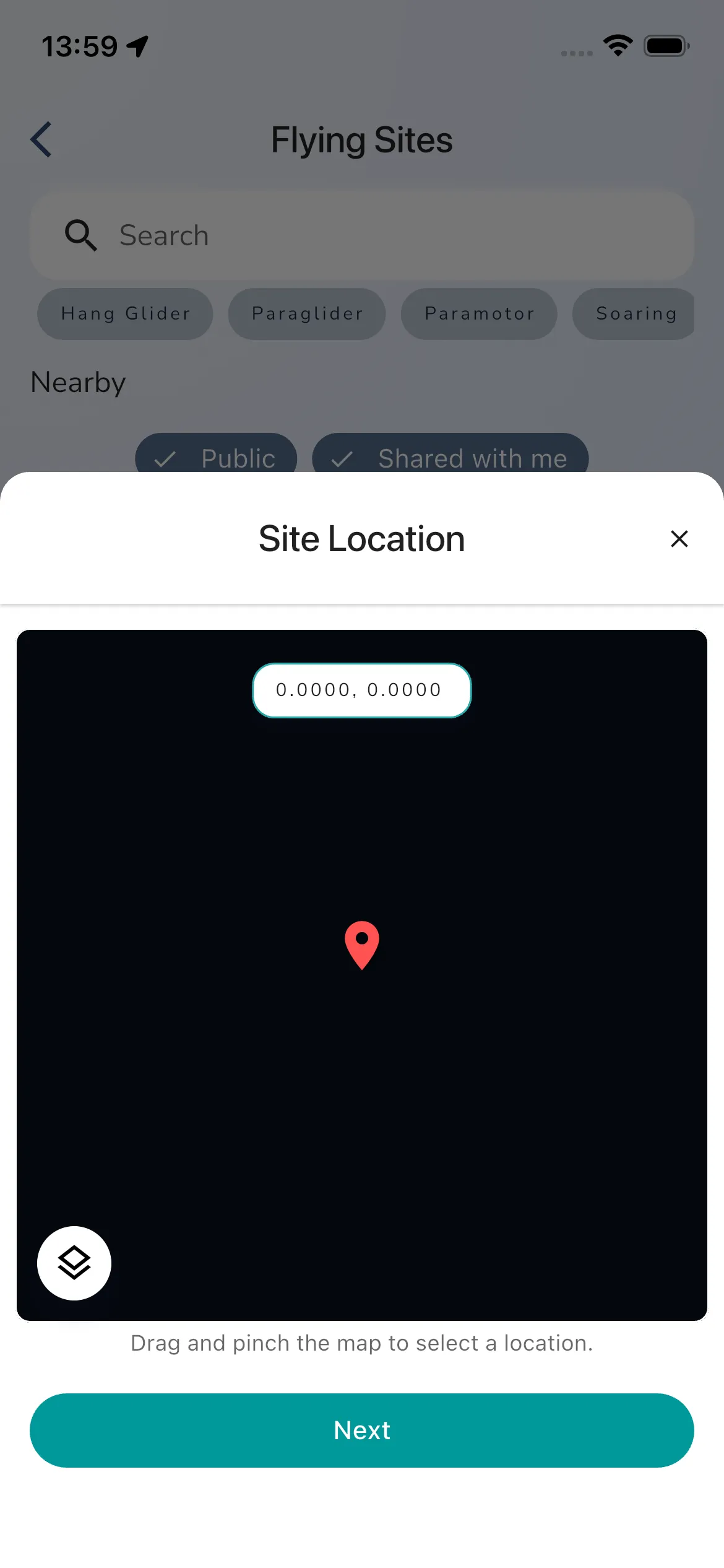
The first step is the Site Location screen. Drag the map to position the pin, then tap Next.
Review nearby-site warnings
After you choose a location, Gaggle checks for existing sites within a small radius.
If a nearby site is found, the app shows a Warning! screen with the existing site preview. From there you can:
- tap Join Site if it is the same site and you want to favourite or open it
- tap Next if you still need to continue creating a separate site
If no nearby site is found, Gaggle skips this warning and opens Site Details directly
Add the site details
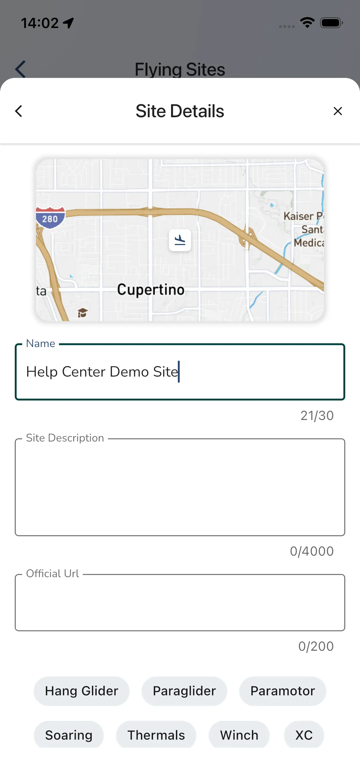
The Site Details step shows a map preview for the selected location and fields for:
- the site name
- a site description
- an official URL
- relevant site tags
Only the name is required to continue. The Next button unlocks once the site name is longer than two characters.
Protection and visibility
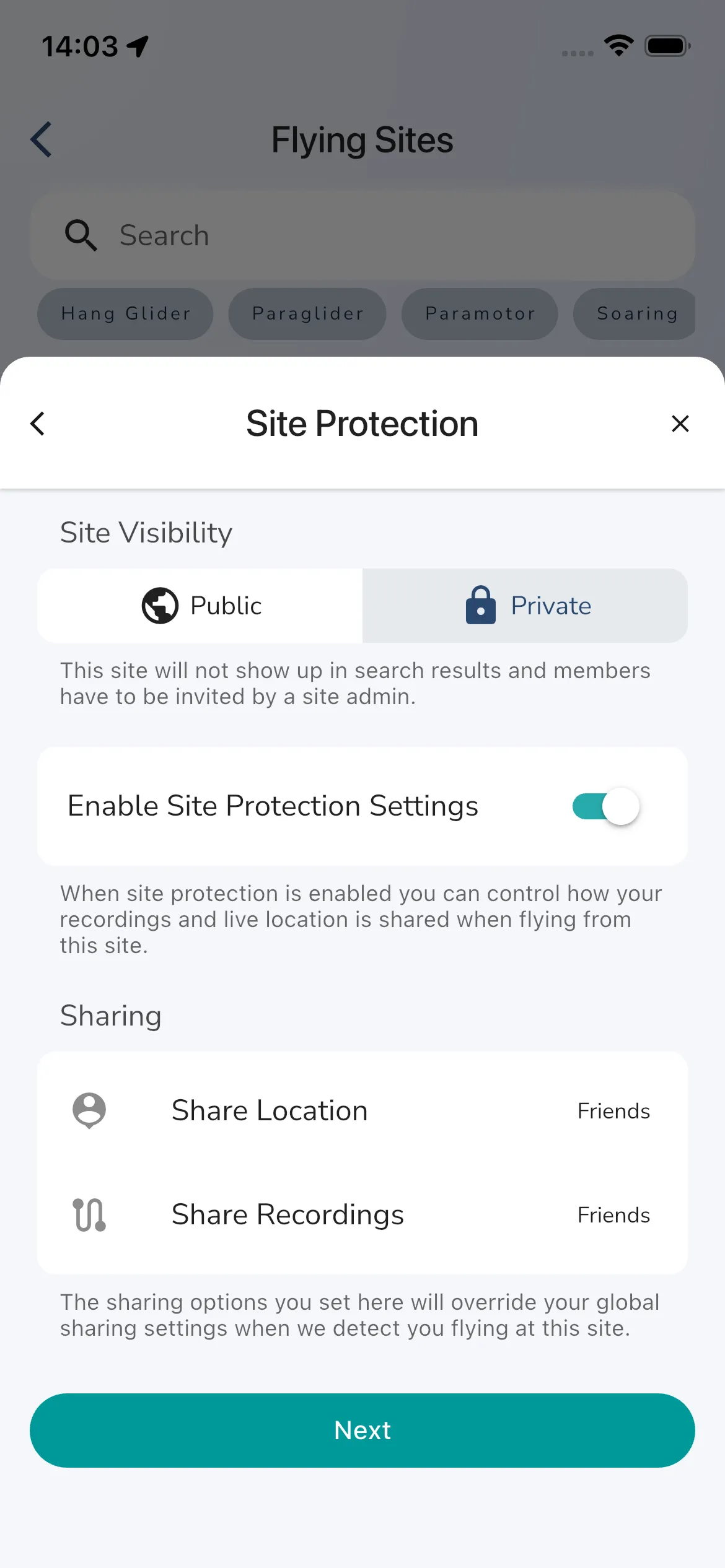
The next step is Site Protection.
Here you can choose whether the site is:
- public
- private
Public sites show in public search results and anyone can view them.
Private sites stay out of search results and members need an invite from a site admin.
In the current create flow, private sites start with Site Protection Settings enabled so flights from that site can override your normal global sharing settings. From there you can set:
- live location sharing
- recording sharing
The default sharing overrides in the current flow are Close Friends for both location and recordings.
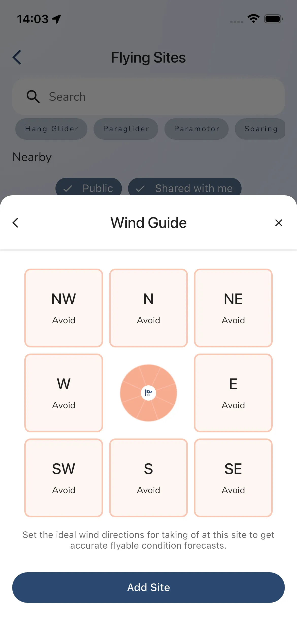
Wind guide
The final setup step is Wind Guide.
Tap each wind tile to cycle through:
AvoidPossibleGood
Set the directions that make sense for takeoff at that site, then tap Add Site.
If you leave every direction on Avoid, Gaggle still creates the site, but the site page shows that the wind guide is not valid yet and tells you to fix it in settings.
Once at least one direction is set to Possible or Good, the site uses that saved wind guide for its weather forecast and flyability views.
Open a site details page
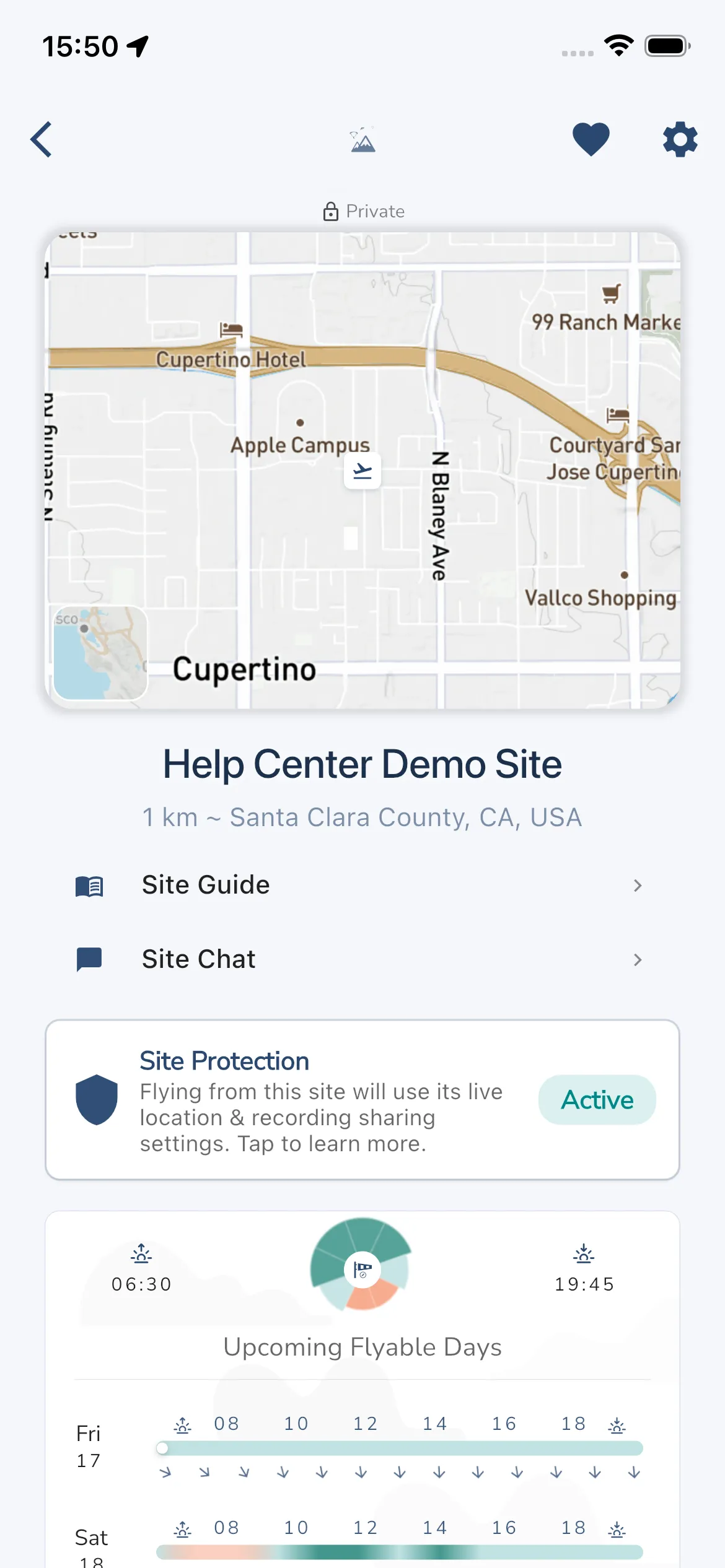
Open any site from Home, Explore, or search to reach the main site page.
This page includes:
- the site map and header
- a quick weather summary with sunrise, sunset, and Upcoming Flyable Days
- the Site Guide
- Site Chat
- protection or sharing details
- settings actions if you can manage the site
Use the site map
The site map gives you a fast visual overview of the launch area and its surroundings.
Use it when you want to:
- confirm the site’s location
- inspect terrain and nearby landmarks
- open the map action sheet
- jump into the dedicated
MaporShow 3D View
If the site has a photo, a small thumbnail sits in the bottom-right corner of the site map. Tap it to see the photo full screen, and close the viewer to come back. Tap the map itself to open the map action sheet. The small weather map in the bottom-left corner opens the same sheet.
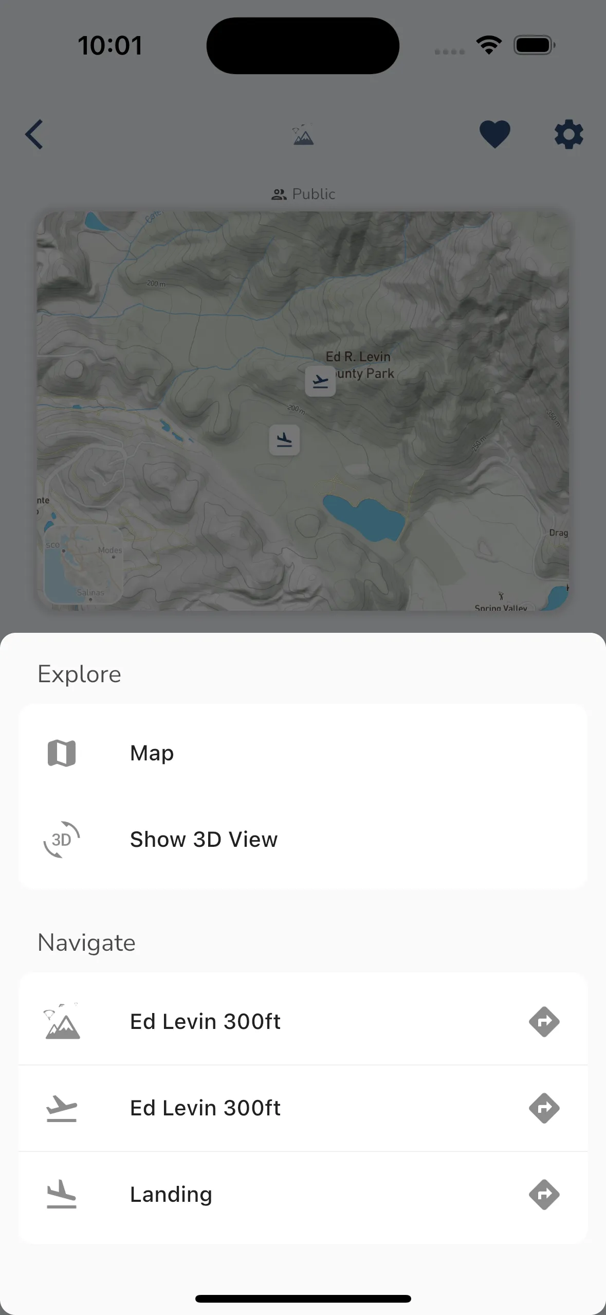
The map action sheet has these parts:
- Explore: Map and Show 3D View
- Driving Directions: a row for the site, each takeoff, each landing and each parking spot. Tap a row to pick a navigation app.
- Navigate > Fly To, in the iOS and Android apps only. It loads the site into navigation.
The action sheet is part of the Adventurer plan. On other plans it opens the upgrade sheet.
Show 3D View opens the terrain around the site in a full-screen 3D view, with the site loaded into it. A spinner shows while it loads. Tap the back arrow at the top (Close) to leave it.
On the Site Guide sheet, tap Translate to read the guide in your language. You can switch back to the original text from the same place.
Use the weather forecast
The site page also acts as the weather entry point for that location.
From the weather card you can:
- check sunrise and sunset times
- review Upcoming Flyable Days when that premium weather card is available on your account
- open Weather Forecast for a deeper forecast view
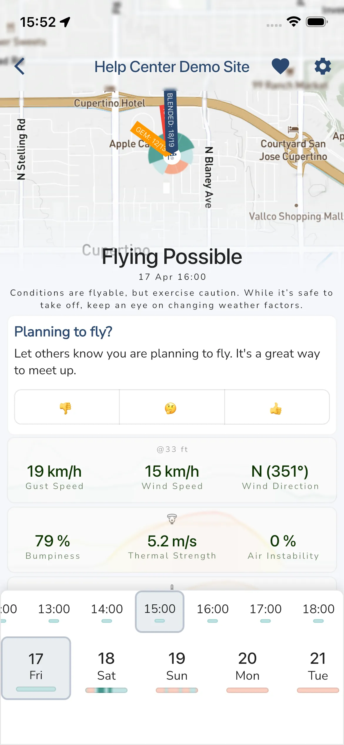
When the wind guide is valid, Weather Forecast opens the full site forecast with:
- the current flyability summary
- planning reactions such as
Planning to fly? - wind, thermal, bumpiness, and precipitation metrics
- hourly forecast columns
- multi-day forecast cards
If the site does not have a usable wind guide yet, Gaggle still opens the forecast page, but it also shows a warning telling admins to fix the wind guide in settings.
Read the site guide
Open Site Guide from the site page when you want the written brief for that location.
Depending on the site, it can include:
- launch notes
- landing notes
- local hazards
- access information
- other flying advice
Use site chat
If site chat is available on your plan, the site page includes a Site Chat row.
Use it to follow local discussion, ask about conditions, and catch unread messages tied to that site. Site chat is part of a paid plan. On other plans the row opens the upgrade sheet. On an airport the row is called Airport Chat.
- Open the site and tap Site Chat. A red dot on the row means there are unread messages.
- Type in the box at the bottom and send. Everyone in the chat sees the message.
- To stop alerts from this chat, use the bell icon at the top right, or the Chat Notifications switch in Site Settings.
Site admins can delete messages. Long-press a message and tap Delete. Other pilots cannot delete messages. See Group Chat for more on how chats work.
Open site settings
The site page includes a settings button in the top-right corner.
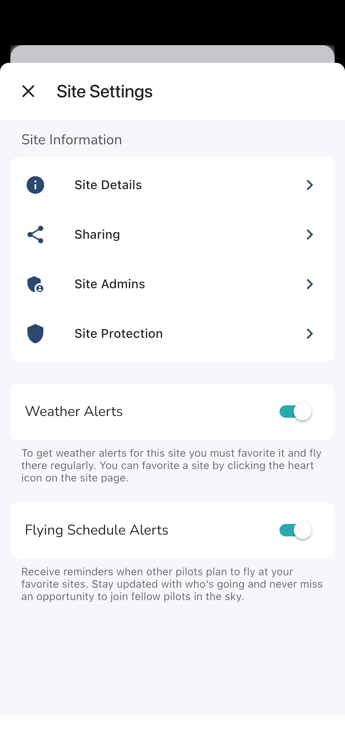
The main Site Settings page can include:
- Site Details
- Sharing
- Site Admins
- Site Protection for private sites
- notification and alert toggles such as Weather Alerts and Flying Schedule Alerts
Site Details settings
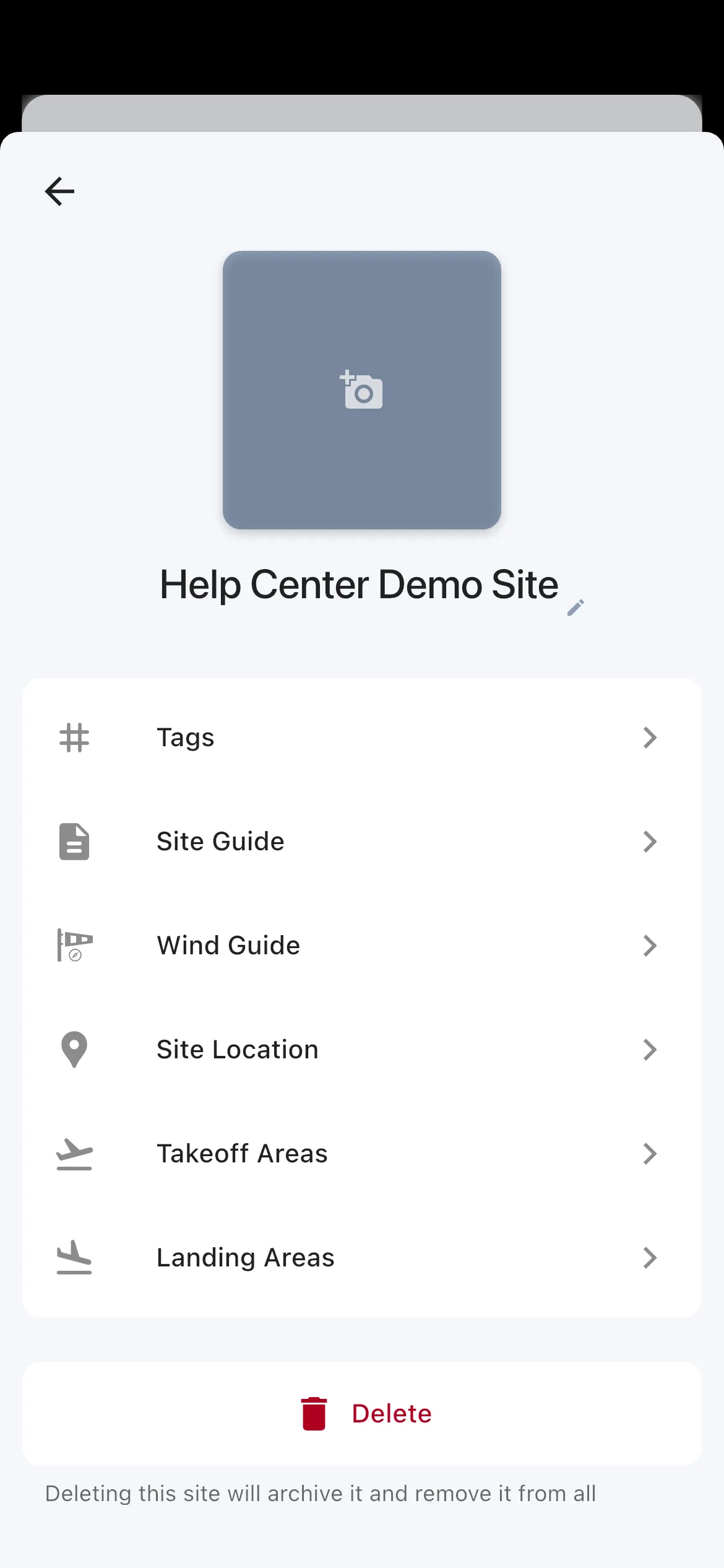
Open Site Settings > Site Details to manage the core site information.
This area includes:
- Tags
- Site Guide
- Wind Guide
- Site Location
- Takeoff Areas
- Landing Areas
- Delete for archiving the site
Site Guide has these text fields: Site Description, Getting There, Weather Notes, Rules, Comments and Official Url.
To add a takeoff or landing area, pick its position on the map. Each one needs a name of at least three characters. It also has a description and Parking Locations, which you add with Add. Tap the area’s position to move it. Delete removes the area at once and does not ask you to confirm.
To change the site photo, tap the photo at the top of Site Details and pick a new image from your gallery. To move the site’s pin, open Site Location. Drag and pinch the map so the pin sits on the right spot, then tap Update Location. The button is off until you move the map. The layers button at the bottom left of the map switches between Satellite and Terrain.
Tags are choice chips. Tap a chip to add the tag, and tap it again to remove it. The choices are Hang Glider, Paraglider, Paramotor, Soaring, Thermals, Winch, XC and Flatland. Tags describe the site, and you can filter the Flying Sites list by them. The Wind Guide shows only Paramotor, Soaring, Thermals and XC.
Use this page when you need to improve the actual site data after creation, not just the initial wizard values.
Sharing settings
Open Site Settings > Sharing to manage who can access the site.
From the current code path, this area lets admins:
- switch the site between Public and Private
- share a private site with My Groups
- share a private site with Pilots Nearby
- open a Share Link
Site Admins
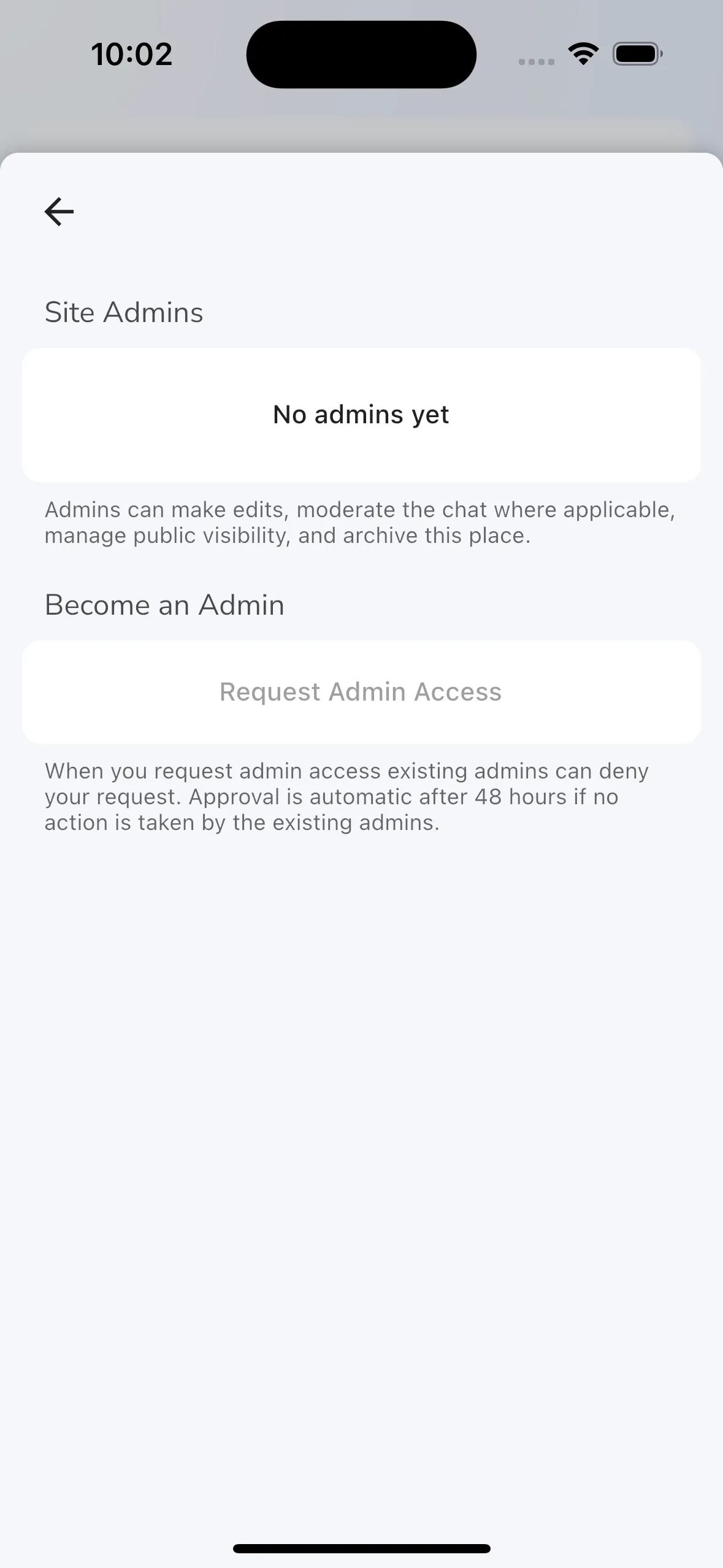
Open Site Settings > Site Admins to see who manages the site.
This page shows the current admin list. Non-admin users can still see this area and tap Request Admin Access. Existing admins can deny the request. If no admin acts, Gaggle approves it automatically after about 48 hours. If you are an admin, you can review incoming admin requests there. Requests for airports are not approved this way.
A site with no admins shows a banner at the top of the site page. Tap it to become an admin and update the site details.
Site Protection settings
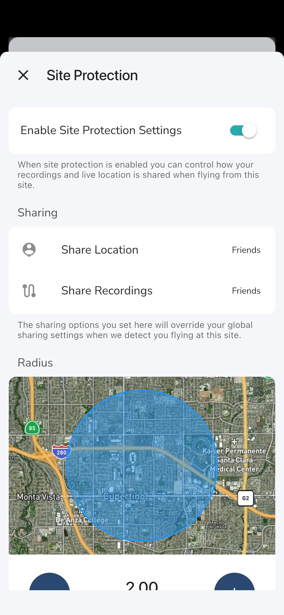
Open Site Settings > Site Protection on a private site when you want the site to override normal sharing behavior during flights from that site.
This page lets admins:
- enable or disable Site Protection Settings
- choose Share Location
- choose Share Recordings
For both Share Location and Share Recordings you pick one of Everyone, Private, My Groups or Close Friends.
The page also has a Radius around the site. Tap the minus and plus buttons to change it. The smallest radius is 200 m. It grows in 100 m steps up to 1 km, then in 250 m steps up to 5 km, which is the largest.
Within that radius, Gaggle uses the site-specific sharing rules instead of your normal global sharing settings.
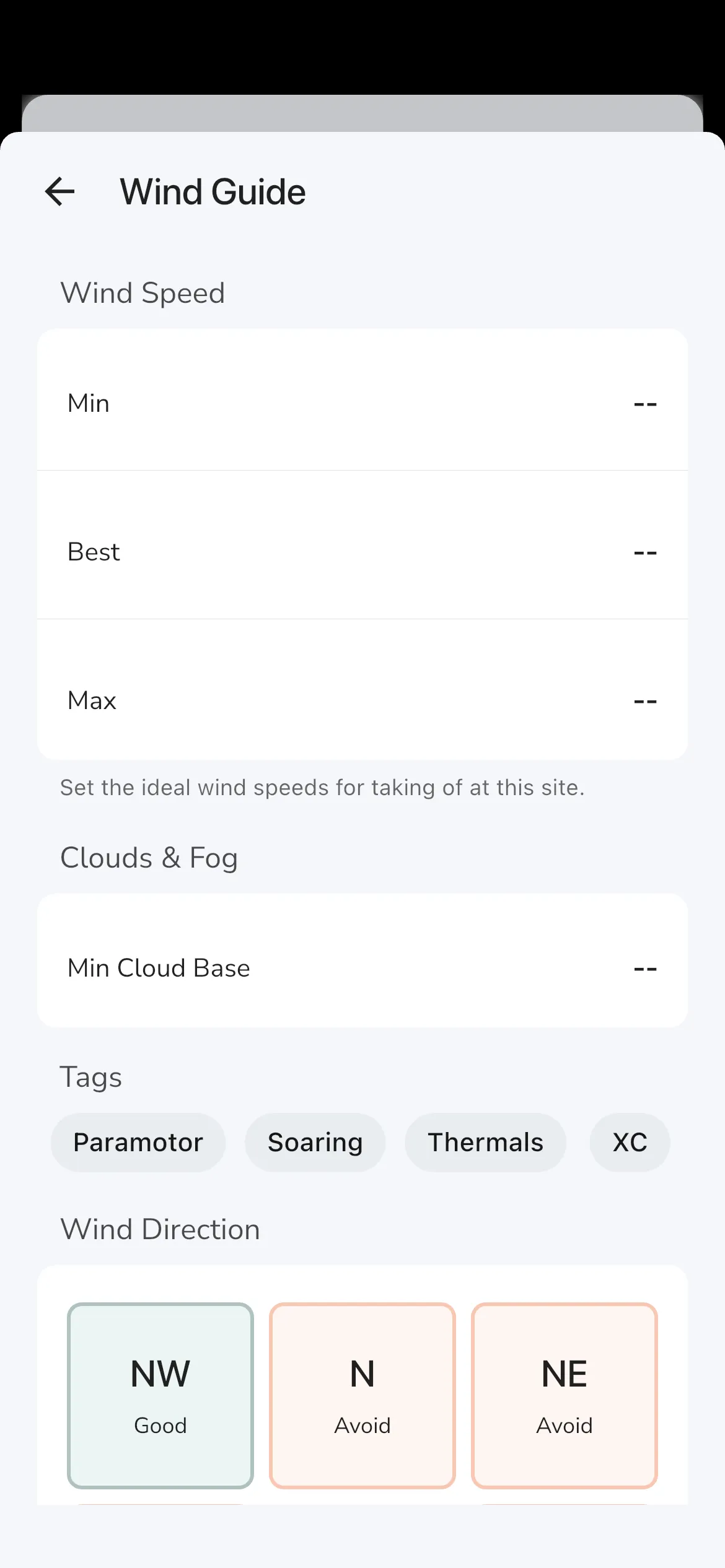
Edit the wind guide after creation
The create flow only captures the quick direction grid. For the full wind guide editor, open:
Site Settings > Site Details > Wind Guide
The detailed editor adds:
- Min, Best, and Max wind speed
- Min Cloud Base
- wind-related tags
- the direction grid for
Avoid,Possible, andGood
Tap a direction tile to cycle through Avoid, Possible, and Good.
At least one direction needs to be Possible or Good for the site to stop showing the invalid wind-guide warning.
Alerts and notifications
The lower part of Site Settings includes your personal alert controls for that site.
Depending on your membership and chat participation, Gaggle can show:
- Chat Notifications
- Weather Alerts
- Flying Schedule Alerts
The Chat Notifications switch turns push notifications from the site chat on or off for you. You need to be a member of the site to get them. You become a member by being an admin, by flying at a public site, or by being invited.
Weather Alerts and Flying Schedule Alerts are on by default. To get weather alerts for a site, favourite it with the heart icon and fly there regularly. Weather alerts are sent to pilots on the Adventurer plan.
Next steps
If you want a forecast-first view of your key sites, go back to Home and use the Flying Sites section.
If you want to keep discovering places nearby, return to Explore and continue from search or the nearby map.