
Help Article
Community Airspaces
Learn how to install community airspace packs, open the Community Hub, and contribute edits
Community Airspaces
Explore > Airspaces > Community Airspaces
Community Airspaces are country or region packs maintained by the Gaggle community. They sit alongside official airspace packs, but they also include contribution and moderation tools for pilots who help improve the map.
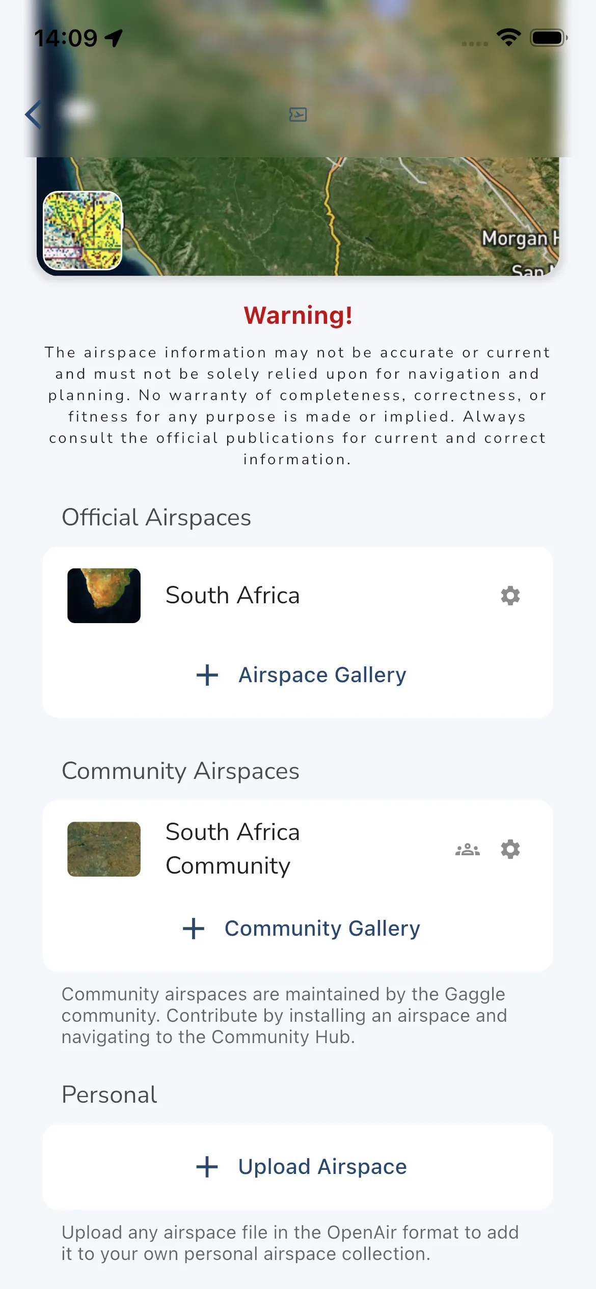
Install A Community Pack
To install a community airspace pack:
- Open Explore > Airspaces.
- Scroll to Community Airspaces.
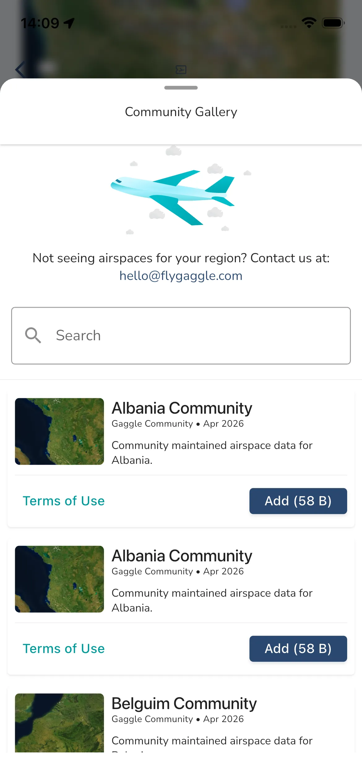
- Tap Community Gallery.
- Search or browse the available packs.
- Tap Add.
Installed packs appear back on the Airspaces page under Community Airspaces. Each row can show:
- The pack name and thumbnail.
- A Community Hub shortcut button.
- A Settings button.
If you remove a community pack, Gaggle records that as an opt-out so it does not get auto-added again from a linked official pack.
Open The Community Hub
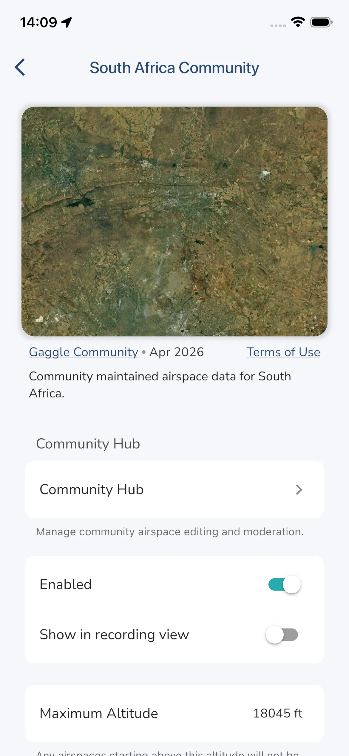
Open the installed community pack, then tap Community Hub. You can also use the group icon from the installed pack row.
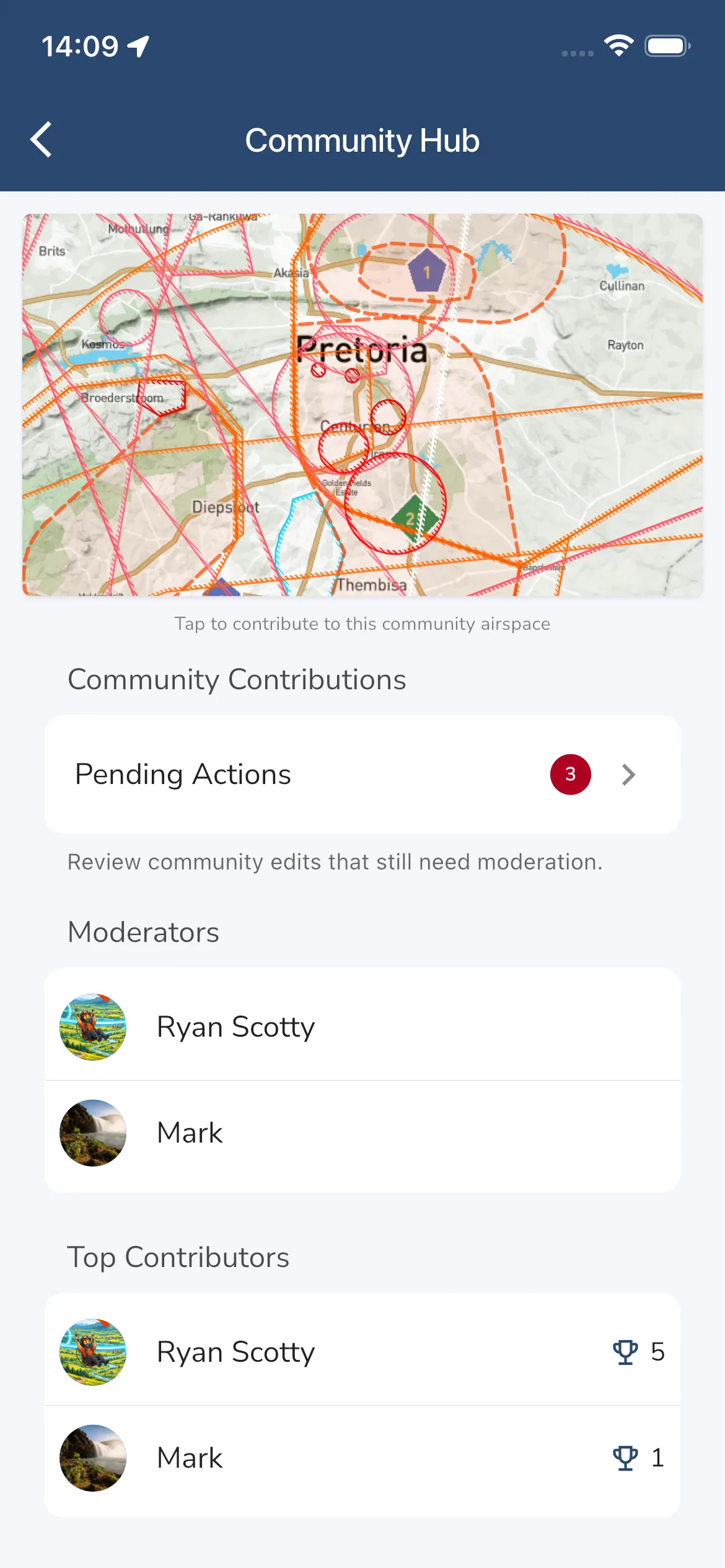
The Community Hub groups the contribution tools for that pack in one place:
- A map preview that opens the editor.
- Community Contributions for pending and rejected edits.
- A Moderators list.
- A Top Contributors list, with the number of approved contributions next to each name.
- A Volunteer as Moderator card when moderator places are available and you are eligible.
Moderators and Top Contributors each show three names. Tap See More when there are more. Tap a name to open that pilot’s profile.
Community editing and moderation is subscription-gated. If your account does not include community-airspace contribution access, these pages do not open normally.
Review Pending Contributions
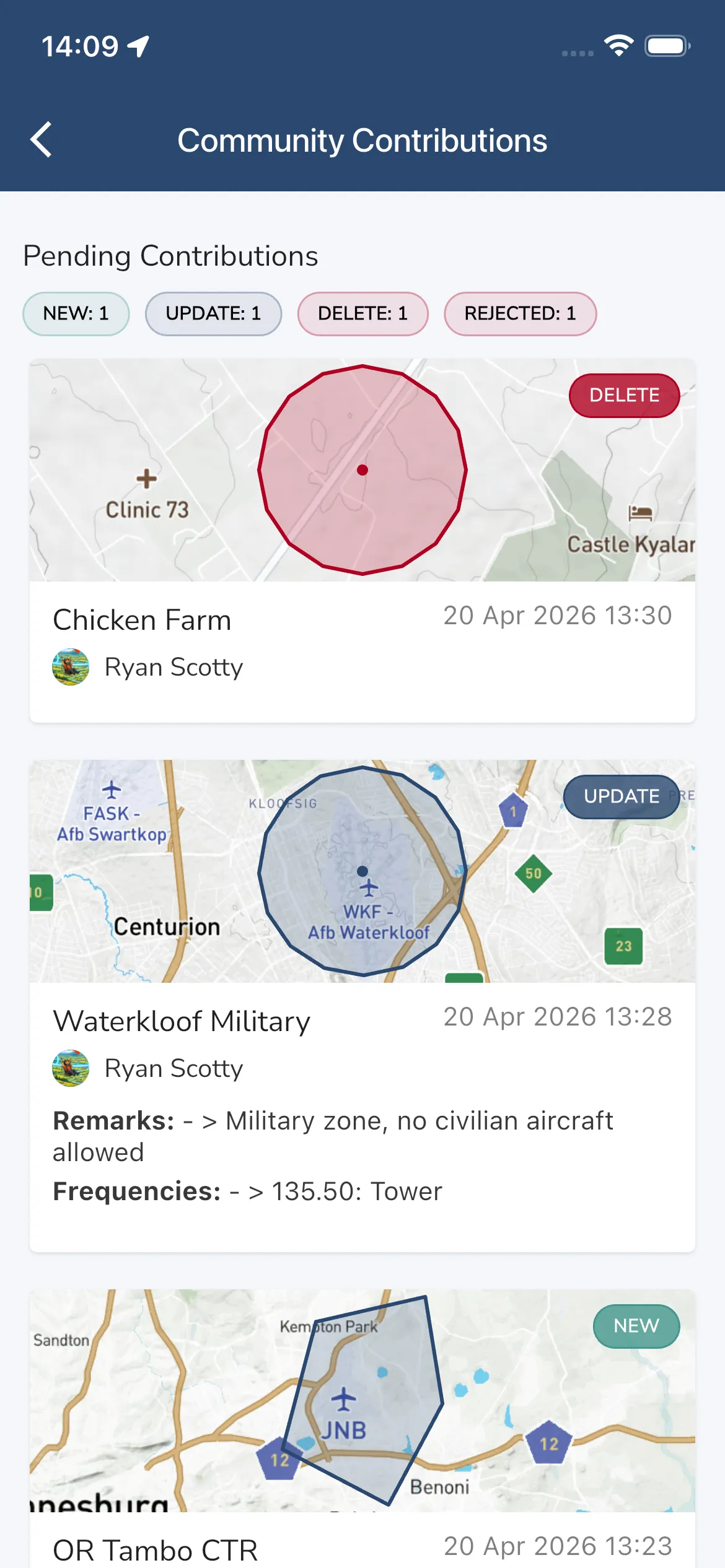
Tap Pending Actions from the Community Hub to open Community Contributions.
This page can show:
- Status chips for New, Update, Delete, and Rejected items.
- A map preview for each proposed change.
- Contributor name and submission time.
- Rejected items with the rejection reason.
If you are a moderator for that pack, pending cards also show Approve and Reject actions. Rejections require a comment.
Contribute In The Editor
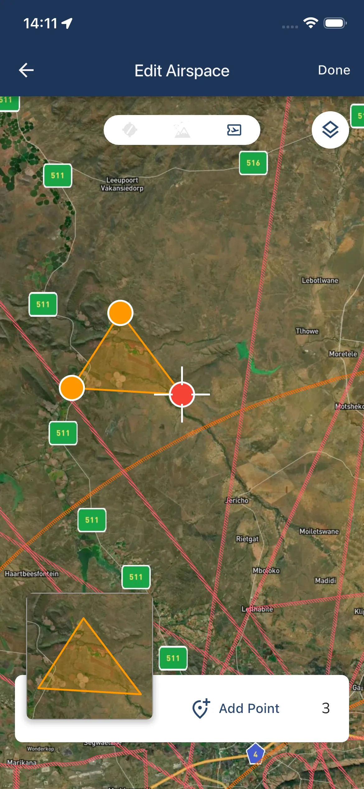
Tap the map preview in the Community Hub to open Edit Airspace.
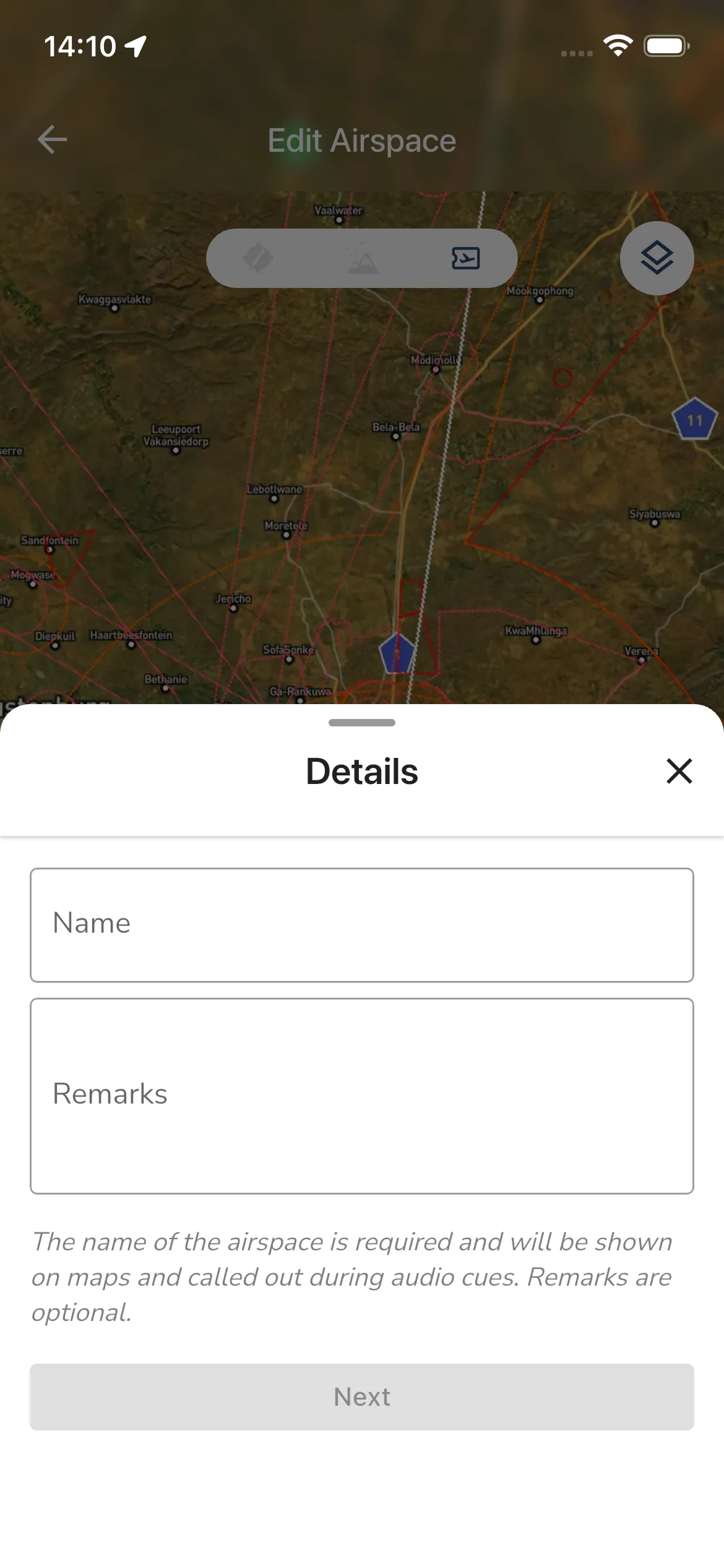
From there you can use the plus button to start a new contribution. The create flow currently walks through these steps:
- Details for the airspace name and optional remarks.
- Airspace Type.
- ICAO Class.
- Vertical Limits.
- Frequencies.
- Temporary Dates when the airspace is only active for a fixed period.
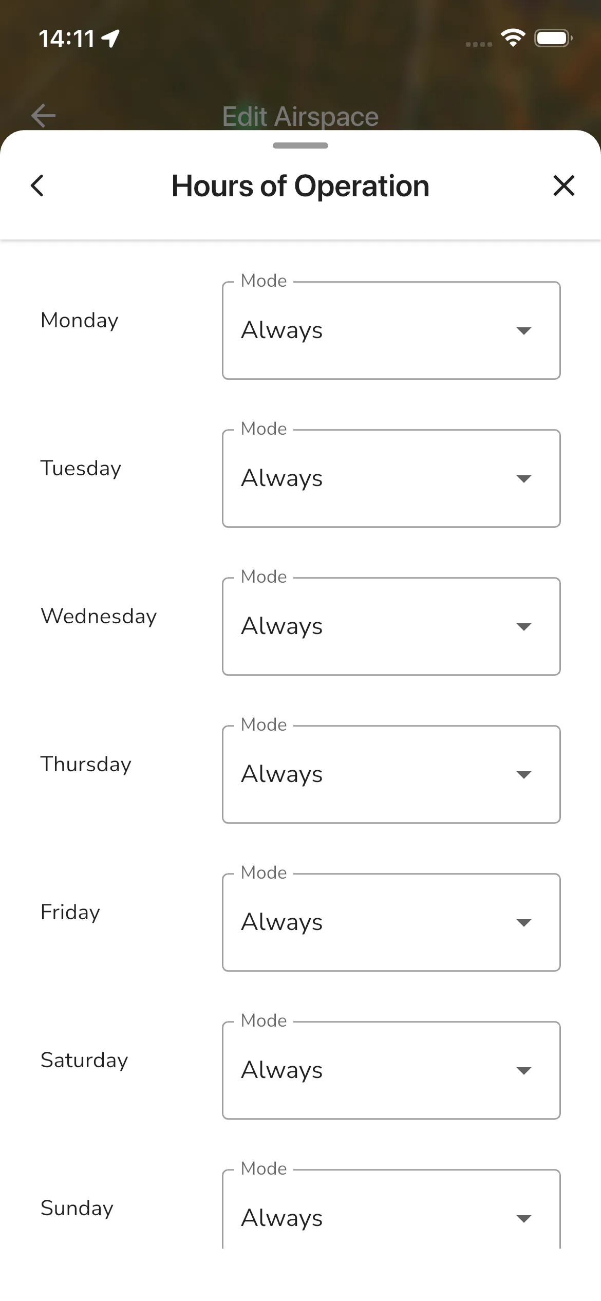
- Hours of Operation for recurring active hours.
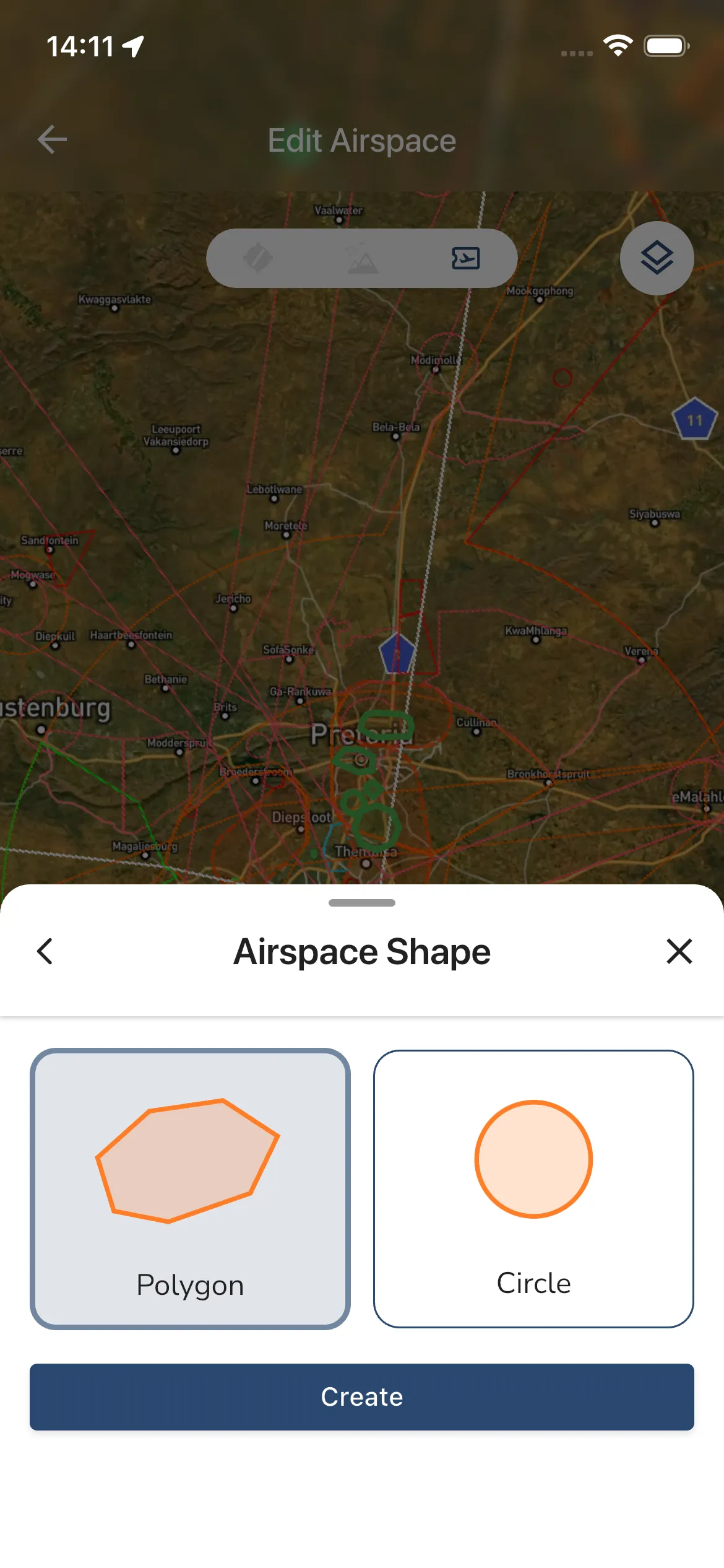
- Airspace Shape to choose Polygon or Circle.
Vertical Limits has a Lower Limit and an Upper Limit. For each one, enter a Value (a whole number), then choose the Units (meters, feet or Flight Level) and the Reference Datum (Ground, Mean Sea Level or Standard Altitude). A flight level always uses Mean Sea Level. Tick Lower limit is ground to set the lower limit to 0 feet above ground. The upper limit cannot be below the lower limit.
In Frequencies, tap Add Frequency for each radio frequency. Each row has a Frequency Name and a Frequency Value. Tap the remove icon on a row to delete it.
In Temporary Dates, set both Active From and Active To, or leave both empty. Tap the close icon on a date, or Clear dates, to remove them. The start cannot be after the end.
In Hours of Operation, choose a Mode for each day: Always, Sunrise - Sunset or Manual Hours. Manual Hours lets you set the start and end time.
Next (Create on the last step) stays off until the step is valid. Step 1 needs a name, and the limits step needs valid values.
Once the shape is created, you can place points on the map and refine the geometry. The editor also lets you:
- Toggle reference layers such as airspaces, airports, and sites.
- Tap an existing community shape to open its summary.
- Choose Edit Details to change the name, type, limits and other details without touching the shape, Edit Airspace to change the shape, or Delete. Delete asks you to confirm.
- Use the layers button to switch the base map between Satellite, Terrain and OpenStreetMap.
- Tap the info button for an explanation of the contribution process.
- Tap Add Point to place each point, then Done when the shape is finished.
- In the web app, while you edit a circle, choose Resize to change its radius or Move to drag its centre.
When you leave with staged changes, Gaggle asks Save Changes? with Cancel, Discard and Save. Saving submits the create, update, or delete proposal for moderation.
Become A Moderator
If you are not already a moderator and the pack still has moderator space available, the Community Hub can show Become a Community Moderator.
Moderators can:
- Review pending contributions.
- Approve valid edits.
- Reject edits that need changes.
Helpful Notes
- Community Airspaces are separate from official airspace packs, even when they cover the same country.
- Installing an official pack can also install a linked community pack automatically.
- Removing a community pack opts you out of that auto-install until you add it manually again.
- If the contribution pages look empty or unavailable, check that you are on the Adventurer plan, which includes community-airspace contributions.