
Help Article
Map View
Use the live map, switch terrain styles, and understand the current long-press route and waypoint actions.
Moving Map Instrument
The moving map is your main in-flight view while recording. It shows your position, route guidance, nearby items, and map overlays you can adjust for your flying style.
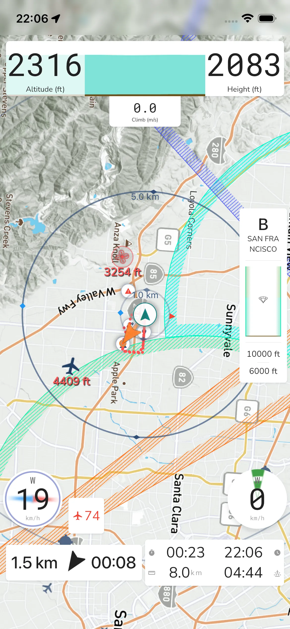
Open map display settings
From the recording screen:
Record -> Recorder Settings -> Configurations -> Default Layout -> Map
You can also tap the gear icon on the in-flight map to open Recorder Settings. The Map row shows the base map you use now. In Map you will find:
Your marker: Choose how your own marker looks on the map.
Base Map: Choose between Satellite, Terrain, Competition, and Sectional. Sectional is part of the Frequent Flyer plan and shows a warning that sectional charts may be out of date and must not be used for navigation.
Weather Radar: Turn Rain Radar on or off on top of the map.
Power Lines: Turn on Show power lines on map to draw every power line and cable on satellite, terrain and sectional maps. Below 150 m above the ground they turn bold red until you climb above 200 m. This is part of the Adventurer plan.
Orientation: Heading turns the map to follow your direction of flight. North keeps north at the top.
thermal.kk7: Show Skyways and Thermals from the thermal.kk7 data, and use Time Filter to filter them by time. This data is under a Creative Commons non-commercial licence.
Map Zoom: Turn on Lock Zoom to keep one zoom level. Zoom gestures are then off and a slider sets the level.
Map Interactions: Turn Pan and Double Tap on or off for the in-flight map.
Traffic Size: Use the slider to set the size of nearby traffic markers.
Map Items: Show or hide Pilot Location, Pilots Nearby, Snail Trail, Waypoints, Glide Shadow, Prediction Vector (where you will be 10 minutes from now) and Distance Rings. Airspaces are not in this list. See Airspaces.
Nearby pilot markers: Choose Auto, Paraglider or Hang Glider for the markers of pilots near you.
Markers: Show or hide Marker, Landing Spot, Landmark, Attraction, Flying Sites, Airports, Show Public Markers and Show Shared Markers.
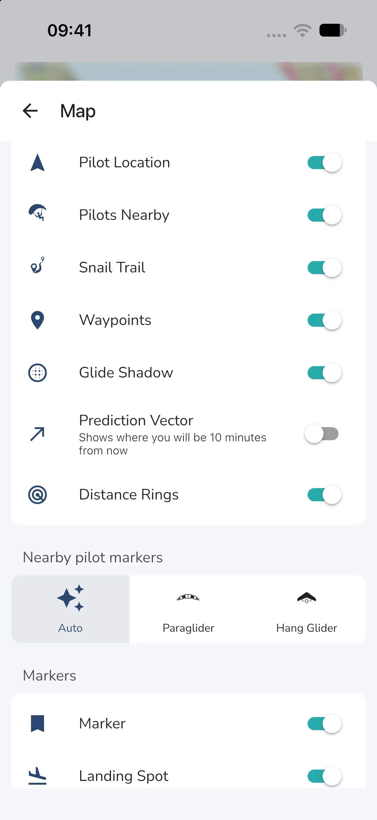
Map buttons in flight
Tap the map to show the buttons on the left of the in-flight map:
Warning icon: Opens System Warnings.
Info icon: Opens the Area Information sheet for your position (described below).
Ruler icon: Starts the measuring tool on flights that use the competition map. Tap the map to add points and read the total distance.
Add annotation icon: On obstacle course flights, lets you draw your own notes and lines on the map.
Zoom in and zoom out: Change the map zoom.
Gear icon: Opens Recorder Settings.
Stop icon: Asks Do you want to stop the recording of your flight? with CONTINUE RECORDING and STOP. On a location-masked competition flight, the sheet also offers Reveal my position while you are in the air, and has no CONTINUE RECORDING button.
Competition flights: A location-masked competition flight has no recorder settings. Stop Recording is under the More menu. The map shows a scale bar, and map zoom stops at the event’s official scale. See Competition flight screen.
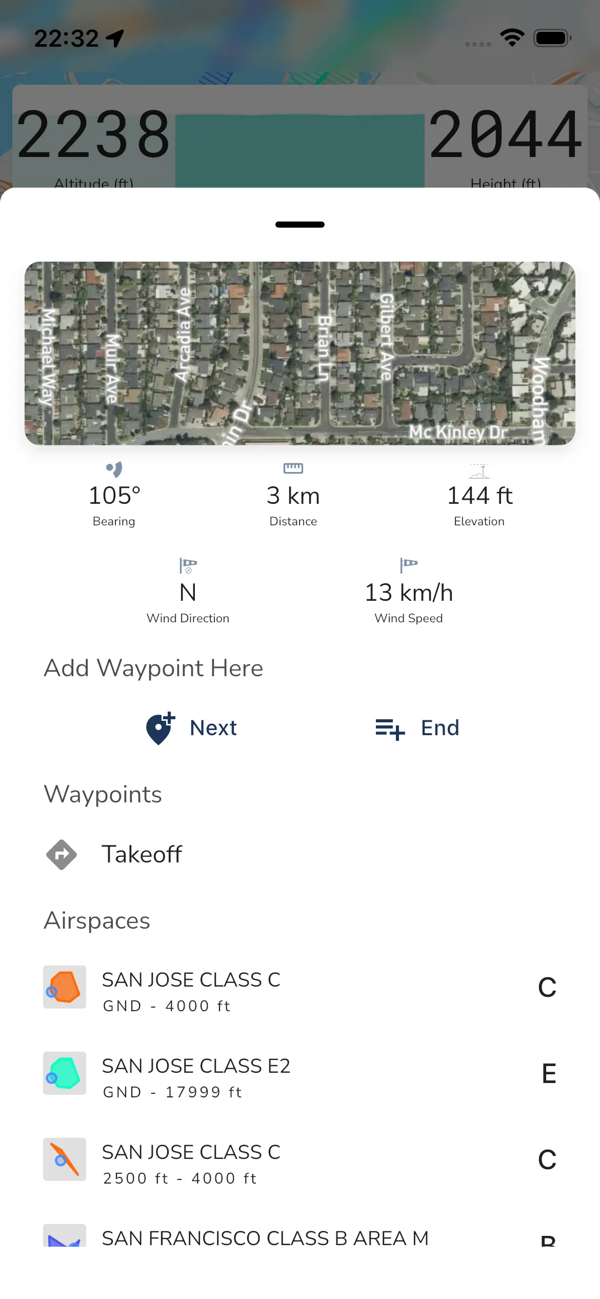
Long press
Long press anywhere on the in-flight map, or tap the info icon, to open the Area Information sheet. It shows details for that point first, then lists of nearby items.
Bearing: The bearing from your current location to the point.
Distance: The distance from your current location to the point.
Elevation: The elevation of the point.
Wind Direction and Wind Speed: The wind for that point.
Add Waypoint Here: Add a waypoint using Next (insert next) or End (append to route end). Waypoints are part of the Frequent Flyer plan.
Airspace advisories: Shown when a notice applies near the point.
Below these, the sheet lists what is near the point. Each list shows only when something is there:
Pilots Nearby: Pilots close to the point, with their altitude.
Waypoints: Waypoints of your route near the point.
Your Takeoff Location: Your Takeoff. Tap the add icon to make it a waypoint.
Points of Interest: Tap a point to see its details. Info and add-waypoint icons sit beside it. Part of the Frequent Flyer plan.
Flying Sites: Same actions as points of interest. Tap a site, or its info icon, to open the flying site sheet. It shows the site’s name and details above Next and End buttons that add it as a waypoint. Part of the Adventurer plan.
Airspaces: Nearby airspaces.
Airports: Same actions as points of interest. The sheet shows the airport information. Part of the Adventurer plan.
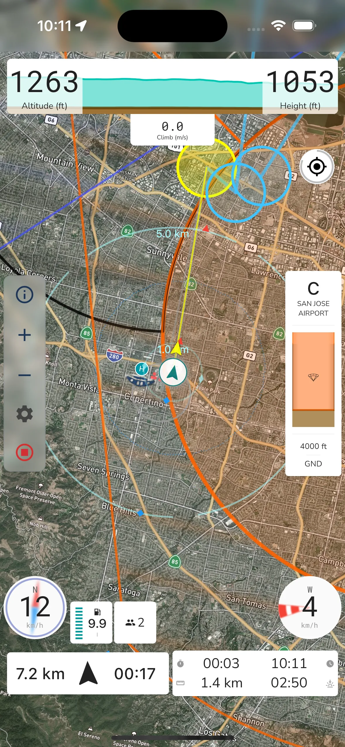
Satellite Map View
Switching to Satellite changes the background imagery while keeping the same in-flight controls and overlays.
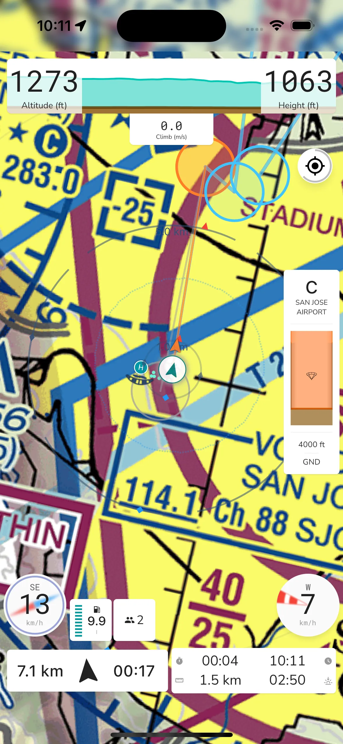
Sectional Map View
If available in your region, you can switch to Sectional in Base Map. This keeps the same controls while using sectional chart tiles.